
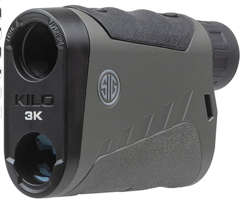
Finding the best rangefinder for surveying can make a significant difference in the accuracy, speed, and efficiency of your work. Whether I’m measuring property boundaries, calculating distances across uneven terrain, conducting forestry assessments, or working on construction projects, I rely on a rangefinder that delivers precise measurements and dependable performance in the field.
The best surveying rangefinders offer long measuring ranges, multiple measurement modes, clear optics, durable weather resistant construction, and convenient features such as Bluetooth connectivity and data storage to simplify data collection.
In this guide, I’ll share my top picks for the best rangefinders for surveying, highlight their key features, explain what makes each one worth considering, provide a helpful buying guide, and answer some of the most frequently asked questions to help you choose the right model for your needs.
Table of Contents
ToggleBest Rangefinder for Surveying
1.Nikon Forestry Pro II Laser Rangefinder
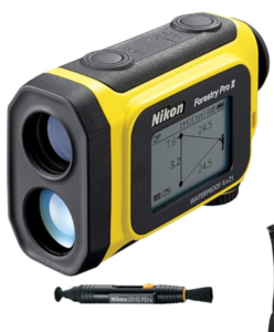 The Nikon Forestry Pro II Laser Rangefinder is an excellent choice for surveyors, forestry professionals, land managers, and anyone who needs accurate distance and height measurements in the field. Designed for demanding outdoor environments, it combines precise laser technology with a bright optical system and convenient data storage features.
Whether you are measuring tree heights, mapping land boundaries, or carrying out general surveying work, this rangefinder delivers reliable performance while remaining easy to use.
One of the most useful features of the Nikon Forestry Pro II is its log function, which allows you to store up to 250 measurement results. This makes it much easier to keep track of multiple readings during large surveying projects without constantly writing down measurements.
Stored results can be recalled quickly, and new measurements appear on the internal display in approximately 0.3 seconds, helping improve productivity when working across large sites.
The Target Priority Switch System is another valuable feature, especially when working in areas with dense vegetation or overlapping objects. The First Target Priority mode displays the distance to the nearest object rather than the background.
This allows surveyors to accurately measure individual trees, survey markers, fence posts, or other foreground targets without interference from objects located behind them. The additional flexibility provided by this system improves confidence when taking measurements in challenging environments.
Optical performance is equally impressive. The Nikon Forestry Pro II features a 6x monocular with a multilayer coating that produces bright, sharp, and clear images. This makes it easier to identify distant targets even under varying lighting conditions. The clear optics reduce eye strain during long surveying sessions while helping users align measurements with greater accuracy.
Field equipment must withstand unpredictable weather, and this model is built with that in mind. The Forestry Pro II is waterproof up to 1 meter for 10 minutes and is also fogproof, allowing it to perform reliably in rainy, humid, or misty conditions.
Although it is not intended for underwater use, its rainproof battery chamber provides additional protection when working outdoors in changing weather.
This bundle adds even more value by including practical accessories for field use. Alongside the Nikon Forestry Pro II Laser Rangefinder, users receive a Nikon Retractable Rangefinder Tether in Truetimber Kanati Realtree Camo, a Binocular Harness for comfortable carrying during long days in the field, and the Nikon Lenspen Cleaning System to help maintain clean optics for consistent performance.
Pros
- Stores up to 250 measurement results with the built in log function
- Measurement results display in approximately 0.3 seconds
- First Target Priority mode improves accuracy when measuring foreground objects
- Bright 6x monocular with multilayer coated optics
- Waterproof and fogproof construction for outdoor use
- Rainproof battery chamber provides additional weather protection
- Includes useful field accessories such as a tether, binocular harness, and lens cleaning system
- Suitable for forestry, surveying, and land management applications
Cons
- Waterproof rating is limited to shallow exposure and not intended for underwater use
- 6x magnification may not be sufficient for extremely long distance observations
- Premium features make it more expensive than entry level laser rangefinders
2.Jim-Gem LHR 1000 Hypsometer/Rangefinder
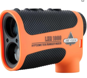
The Jim-Gem LHR 1000 Hypsometer/Rangefinder is an excellent choice for surveyors, foresters, land managers, and environmental professionals who need a reliable instrument for measuring distance, height, and slope. Combining multiple measurement functions into one rugged device, it simplifies fieldwork while delivering the precision required for surveying, timber cruising, and terrain analysis.
Its durable construction and easy-to-use interface make it well suited for both experienced professionals and those new to laser surveying equipment.
One of the biggest strengths of the Jim-Gem LHR 1000 is its ability to perform several important surveying tasks with a single device. It functions as a professional laser hypsometer and rangefinder, allowing users to measure distance, height, angle, and slope without carrying multiple instruments.
This versatility makes it ideal for forestry management, construction planning, property surveys, and environmental assessments where different types of measurements are required throughout the day.
The rangefinder offers an extended measuring range of up to 1,000 yards, providing dependable performance across large work sites. Whether measuring tree heights across a forest stand or determining distances over uneven terrain, the long operating range allows surveyors to complete measurements efficiently while maintaining reliable accuracy.
Its precision readings help improve confidence when collecting data for mapping, land management, or timber valuation.
Another feature that makes this model particularly useful is its six measurement modes. Users can choose between 3 point height, 2 point height or missing line, vertical distance, horizontal distance, degree slope, and percent slope measurements.
This flexibility enables the device to adapt to a wide variety of surveying situations without requiring additional equipment. The different measurement options are especially valuable when working on sloped ground or when direct measurements are difficult to obtain.
The Scan Mode further improves efficiency during field operations by providing continuous rolling measurements of height, distance, and angles across all measurement modes. Instead of taking individual readings one at a time, surveyors can quickly collect multiple measurements while moving through the work area.
This helps save time during large surveys and makes it easier to identify the most accurate measurement when scanning multiple targets.
Viewing measurements is simple thanks to the clear in scope LCD display, which presents measurement values and icons directly within the user’s line of sight. This design reduces the need to look away from the target and allows measurements to be read quickly while maintaining focus on the object being surveyed.
The display remains easy to read in a variety of outdoor lighting conditions, helping improve productivity in the field.
Designed for demanding environments, the Jim-Gem LHR 1000 features an IP67 waterproof housing that protects the unit from dust and water exposure during outdoor work. The 6x monocular provides a clear view of distant targets, making it easier to align measurements accurately.
The package also includes practical accessories such as a battery, lanyard, cleaning cloth, and protective carrying case, allowing users to begin fieldwork immediately while keeping the instrument protected during transport.
Pros
- Measures distance, height, angle, and slope in one device
- Extended measuring range of up to 1,000 yards
- High accuracy for forestry and surveying applications
- Six measurement modes for greater flexibility
- Continuous Scan Mode speeds up field data collection
- Clear in scope LCD display is easy to read
- IP67 waterproof construction for rugged outdoor environments
- Includes battery, lanyard, cleaning cloth, and protective carrying case
Cons
- 6x magnification may be limiting for extremely distant targets
- Advanced measurement functions may require some practice for first time users
- Designed primarily for professional field applications rather than casual recreational use
3.Leica Disto X6 800 ft Rangefinder
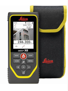 The Leica Disto X6 800 ft Rangefinder is a professional laser distance measuring tool designed for surveyors, engineers, construction professionals, and anyone who requires highly accurate measurements. Combining advanced laser technology with smart digital features, it offers exceptional precision while making complex measuring tasks faster and more efficient.
Its rugged construction and versatile functionality make it one of the best rangefinders for surveying, especially when working on construction sites, land surveys, or engineering projects.
One of the most impressive features of the Leica Disto X6 is its 800 foot measuring range, allowing users to measure long distances with confidence. Whether you are determining property boundaries, measuring building dimensions, or collecting site data, the extended range helps reduce the need for repeated measurements and improves overall efficiency.
The laser measuring system is designed to deliver reliable accuracy across a wide range of indoor and outdoor applications.
The inclusion of Point to Point (P2P) technology significantly expands the capabilities of this rangefinder. Instead of measuring only from the user’s position to a target, P2P technology allows measurements to be taken between two remote points. This is particularly useful when direct access to a measurement location is difficult or unsafe.
Surveyors can measure the distance between elevated structures, building features, or other inaccessible locations without physically moving to each point, saving valuable time during fieldwork.
Another valuable feature is the built in Pointfinder camera, which improves target acquisition over long distances. The camera helps users accurately identify measurement points, especially in bright outdoor conditions where the laser dot may be difficult to see with the naked eye. This improves confidence when measuring distant objects and enhances overall accuracy during surveying tasks.
The Leica Disto X6 also supports Bluetooth data transfer, allowing measurements to be sent directly to compatible smartphones, tablets, or computers. This wireless connectivity simplifies data collection by reducing manual recording and minimizing transcription errors.
Surveyors can quickly integrate measurements into digital plans, reports, or mapping software, improving workflow efficiency and project documentation.
Versatility is another major advantage of this model. It includes various measurement functions that allow users to perform multiple types of calculations using a single instrument. This flexibility makes the Disto X6 suitable for surveying, construction, architecture, facility management, and engineering projects where different measurement methods are required throughout the day.
Built with professional users in mind, the Leica Disto X6 is designed to perform reliably in demanding environments. Its intuitive controls and advanced measurement capabilities make it an excellent investment for professionals seeking both precision and productivity in the field.
Pros
- Measures distances up to 800 feet
- Point to Point technology measures between remote locations
- Built in Pointfinder camera improves target visibility
- Bluetooth data transfer simplifies digital data collection
- Multiple measurement functions increase versatility
- Highly accurate for surveying and construction applications
- Suitable for both indoor and outdoor measurements
- Compact and easy to carry in the field
Cons
- Premium price compared to basic laser distance meters
4.Leica DISTO X6 P2P Kit Rangefinder
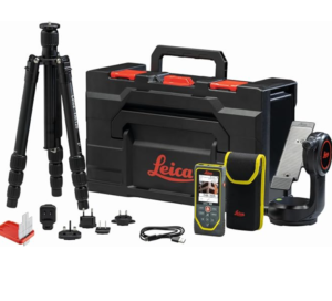 The Leica DISTO X6 P2P Kit is a professional-grade laser measuring solution built for surveyors, engineers, architects, and construction professionals who require exceptional accuracy and advanced measuring capabilities.
More than just a standard rangefinder, this complete kit combines the Leica DISTO X6 laser distance meter with the DST360x adapter and a tripod, allowing users to perform highly accurate Point to Point measurements in both indoor and outdoor environments. Its advanced technology and comprehensive accessories make it one of the best rangefinders for surveying.
One of the biggest advantages of this kit is its 800 foot measuring range, which allows professionals to capture accurate distance measurements across large job sites. Whether measuring property boundaries, building dimensions, structural components, or landscape features.
The extended measuring range improves efficiency by reducing the need to reposition the instrument. The included DST360x further enhances measurement precision by enabling accurate Point to Point calculations between remote locations.
The Point to Point (P2P) technology is particularly valuable for surveying applications. Instead of requiring direct access to every measurement point, the system can calculate the distance between two remote targets.
This capability is especially useful when measuring rooftops, elevated structures, building facades, or locations that are difficult or unsafe to access. By reducing the need for manual measurements, the P2P system saves time while improving productivity on complex projects.
To improve target acquisition, the Leica DISTO X6 features a built in Pointfinder camera. The camera makes it much easier to identify distant measuring points, especially in bright outdoor conditions where the laser beam may be difficult to see. This results in greater confidence when aiming at targets and helps maintain measurement accuracy across long distances.
The rangefinder also includes Bluetooth data transfer, allowing measurements to be sent directly to compatible smartphones, tablets, or computers. Wireless connectivity simplifies digital documentation by reducing manual data entry and minimizing transcription errors.
Surveyors can quickly transfer measurements into project files, CAD software, or digital reports, creating a more efficient workflow from the field to the office.
Another strength of the Leica DISTO X6 P2P Kit is its wide selection of measurement functions, enabling users to perform various measuring tasks with a single instrument. This versatility makes it suitable for surveying, construction, architecture, engineering, and facility management.
The included carry case, charging cord, tripod, and DST360x adapter provide everything needed to begin professional field measurements immediately.
The Leica DISTO X6 operates using a Class 2 laser with an output of 0.9 mW and a 635 nm wavelength, delivering reliable measurement performance while complying with recognized laser safety standards. Combined with Leica’s reputation for precision engineering, this makes the instrument a dependable choice for demanding professional applications.
Pros
- Complete professional measuring kit with DISTO X6, DST360x, tripod, and carry case
- Measures distances up to 800 feet
- Point to Point technology measures between remote locations
- Built in Pointfinder camera improves target visibility outdoors
- Bluetooth connectivity allows quick digital data transfer
- Multiple measurement functions increase versatility
- Suitable for indoor and outdoor surveying applications
- Class 2 laser provides reliable measurement performance
- Helps improve efficiency on complex surveying and construction projects
Cons
- Full functionality requires time to learn and master
5.SIG SAUER KILO3K 6x22mm Rangefinder
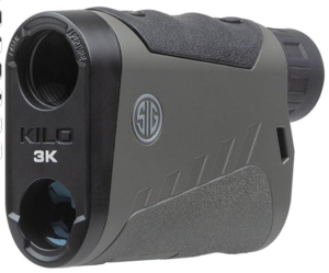
The SIG SAUER KILO3K 6x22mm Rangefinder is a high performance laser rangefinder that combines impressive ranging capability, fast processing speeds, and advanced digital technology in a compact design.
Although it is primarily designed for long range shooting and hunting, its exceptional accuracy and long measuring range also make it a strong option for surveying, forestry, land management, and outdoor mapping projects. Professionals who need reliable measurements across large distances will appreciate its combination of speed, precision, and smart connectivity.
One of the biggest advantages of the KILO3K is its Lightwave DSP (Digital Signal Processing) engine, which delivers exceptionally fast target acquisition and distance calculations. The streamlined operating system is easy to navigate, allowing users to obtain measurements quickly without working through complicated menus.
This efficient performance is particularly valuable during surveying projects where multiple measurements must be collected over a large area in a short amount of time.
The KILO3K offers several range modes that increase its versatility in different environments. These include Line of Sight (LOS) for direct distance measurements, Angle Modified Range (AMR) for calculating distances over uneven terrain, Archery Mode (ARCH), Applied Ballistics Ultralight (BDX U), and Applied Ballistics External (BDX X).
For surveying professionals, the Line of Sight and Angle Modified Range modes are especially useful when measuring across hillsides, valleys, and sloped landscapes where elevation changes can affect distance calculations.
Long range performance is another reason this model stands out. The KILO3K can measure reflective targets out to 3,000 yards, making it suitable for surveying expansive properties, forestry operations, and infrastructure projects.
The segmented OLED display presents distance measurements along with additional data in a bright, easy to read format. The clear display remains visible under varying lighting conditions, allowing users to quickly verify measurements while working outdoors.
The rangefinder also incorporates built in environmental sensors that collect real time atmospheric information for enhanced calculations. Using Applied Ballistics Ultralite, the system includes a comprehensive bullet database capable of storing 25 bullet profiles and 8 ballistic groups.
While these ballistic functions are designed for precision shooting, the environmental sensors demonstrate the instrument’s advanced processing capabilities and contribute to reliable calculations under changing outdoor conditions.
Connectivity is another area where the KILO3K performs well. It is BDX 2.0 enabled and features low energy long range Bluetooth technology. The rangefinder can connect to the BaseMap app, allowing users to create remote waypoints on ranged targets.
It can also be fully configured using the SIG SAUER BDX app, giving users additional control over settings and customization. These wireless features can also benefit professionals who manage digital mapping or field data collection.
Despite its advanced capabilities, the KILO3K remains compact and lightweight, making it easy to carry throughout long days in the field. Its 6×22 mm optical system provides a clear view of distant targets, while the waterproof construction allows dependable operation in challenging weather conditions.
Pros
- Measures reflective targets up to 3,000 yards
- Fast Lightwave DSP processing delivers quick measurements
- Multiple range modes increase measurement flexibility
- Angle Modified Range improves accuracy on sloped terrain
- Bright segmented OLED display is easy to read
- Built in environmental sensors provide real time calculations
- Bluetooth connectivity supports wireless configuration
- Compatible with the BaseMap and SIG SAUER BDX apps
- Compact and lightweight for convenient field use
- Waterproof construction for outdoor reliability
Cons
- Premium performance comes with a higher price than basic rangefinders.
Factors to Consider When Choosing the Best Rangefinder for Surveying.
Here are the most important considerations
1. Measurement Range
The maximum measuring distance is one of the most important factors to consider. A longer range allows you to measure large properties, construction sites, forests, and open terrain without moving frequently. Choose a model with sufficient range for the type of surveying work you perform most often.
2. Measurement Accuracy
Accuracy directly affects the quality of your survey data. A reliable rangefinder should deliver consistent distance, height, and angle measurements with minimal deviation. High precision helps reduce errors and ensures dependable results for mapping, boundary surveys, and construction projects.
3. Available Measurement Modes
Different surveying tasks require different measurement functions. Features such as horizontal distance, vertical distance, slope measurement, angle compensation, height calculation, and point to point measurement make the instrument more versatile. Selecting a rangefinder with multiple measurement modes allows it to handle a wider variety of field applications.
4. Optical Quality
Clear optics make it easier to identify distant targets and improve measurement accuracy. A quality monocular with coated lenses provides brighter, sharper images and reduces eye strain during extended fieldwork. Good optical performance is especially valuable when working in bright sunlight or low light conditions.
5. Durability and Weather Resistance
Surveying often takes place in challenging outdoor environments. A durable rangefinder with waterproof, fogproof, and shock resistant construction can continue operating reliably in rain, dust, humidity, and rough terrain. Rugged construction also helps extend the lifespan of the equipment.
6. Display and Ease of Use
A bright, easy to read display allows measurements to be viewed quickly in different lighting conditions. Simple controls and intuitive menus help users access measurement functions efficiently, reducing delays and improving productivity during field surveys.
7. Data Storage and Connectivity
Modern rangefinders often include internal memory and wireless connectivity for transferring measurements to smartphones, tablets, or computers. These features simplify data management, reduce manual recording errors, and make it easier to organize survey results for reporting or mapping software.
8. Portability and Accessories
A lightweight and compact design makes a rangefinder more comfortable to carry during long days in the field. Useful accessories such as a protective case, tripod compatibility, carrying harness, lanyard, and cleaning tools add convenience while helping protect the instrument and improve measurement stability when needed.
Advantages of Using a Rangefinder for Surveying
1. Faster Measurements
A rangefinder allows surveyors to measure distances almost instantly, reducing the time needed to complete fieldwork. This enables professionals to cover larger areas more efficiently and improves overall productivity on surveying projects.
2. Improved Accuracy
Modern rangefinders provide highly accurate distance, height, and angle measurements, helping minimize human error. Accurate data leads to better mapping, planning, and construction outcomes while reducing the need for repeated measurements.
3. Increased Safety
A rangefinder allows measurements to be taken from a safe distance, eliminating the need to access hazardous or hard to reach locations. This is especially useful when surveying steep slopes, busy roads, water bodies, or elevated structures.
4. Greater Efficiency on Large Sites
Long measuring ranges make it possible to collect data across large properties, forests, and construction sites without constantly changing position. This saves time and reduces physical effort during field surveys.
5. Versatile Measurement Functions
Many rangefinders can measure not only distance but also height, slope, horizontal distance, vertical distance, and angles. This versatility allows one instrument to handle a wide range of surveying tasks, reducing the need for additional equipment.
6. Better Data Management
Many modern rangefinders include data storage and wireless connectivity, allowing measurements to be saved and transferred directly to mobile devices or computers. This reduces manual data entry, minimizes recording errors, and simplifies report preparation.
7. Reliable Performance in Outdoor Conditions
Quality rangefinders are designed to withstand rain, dust, humidity, and changing weather conditions. Their durable construction allows surveyors to continue working confidently in demanding outdoor environments.
8. Reduced Physical Effort
Using a rangefinder minimizes the need to stretch measuring tapes or walk long distances between points. This reduces fatigue during long surveying sessions and allows surveyors to complete more work with less physical effort.
Best Rangefinder for Surveying FAQs
1. What is the best rangefinder for surveying?
The best rangefinder for surveying depends on the type of work you perform. For professional land surveying and construction projects, choose a model that offers high measurement accuracy, long measuring range, multiple measurement modes, and a rugged weather resistant design.
Features such as Bluetooth connectivity, data storage, and point to point measurement can also improve efficiency during fieldwork.
2. Can a hunting rangefinder be used for surveying?
Yes, some hunting rangefinders can be used for basic surveying tasks because they provide accurate distance measurements over long ranges. However, professional surveying often requires additional features such as height measurement, slope calculation, horizontal distance, point to point measurement, and data transfer capabilities.
If surveying is your primary application, a rangefinder designed with professional measurement functions is usually the better choice.
3. What features should I look for in a surveying rangefinder?
When choosing a surveying rangefinder, look for accurate distance measurements, sufficient measuring range, multiple measurement modes, clear optics, a bright display, and durable waterproof construction.
It is also beneficial to choose a model with Bluetooth connectivity, internal data storage, tripod compatibility, and a lightweight design for improved productivity and convenience during fieldwork.
Conclusion
Choosing the best rangefinder for surveying comes down to selecting a model that delivers the right balance of accuracy, measuring range, durability, and ease of use for your specific projects. Whether you are surveying land, measuring building dimensions, mapping forested areas, or working on construction sites, a dependable rangefinder can improve efficiency while providing precise and consistent measurements.
Features such as multiple measurement modes, long distance capability, Bluetooth connectivity, and weather resistant construction further enhance performance in demanding field conditions. By investing in a quality rangefinder that matches your surveying needs, you can complete measurements more quickly, reduce errors, and achieve reliable results on every project.